Thinking about a move to Greenwich Proper and its beautiful Long Island Sound shoreline? You want the lifestyle, but you also want clarity on tides, storms, and what it means for your home. This guide gives you a straightforward plan to understand flood risk, permits, insurance, and smart steps to protect your investment. Let’s dive in.
What coastal risk looks like in Greenwich
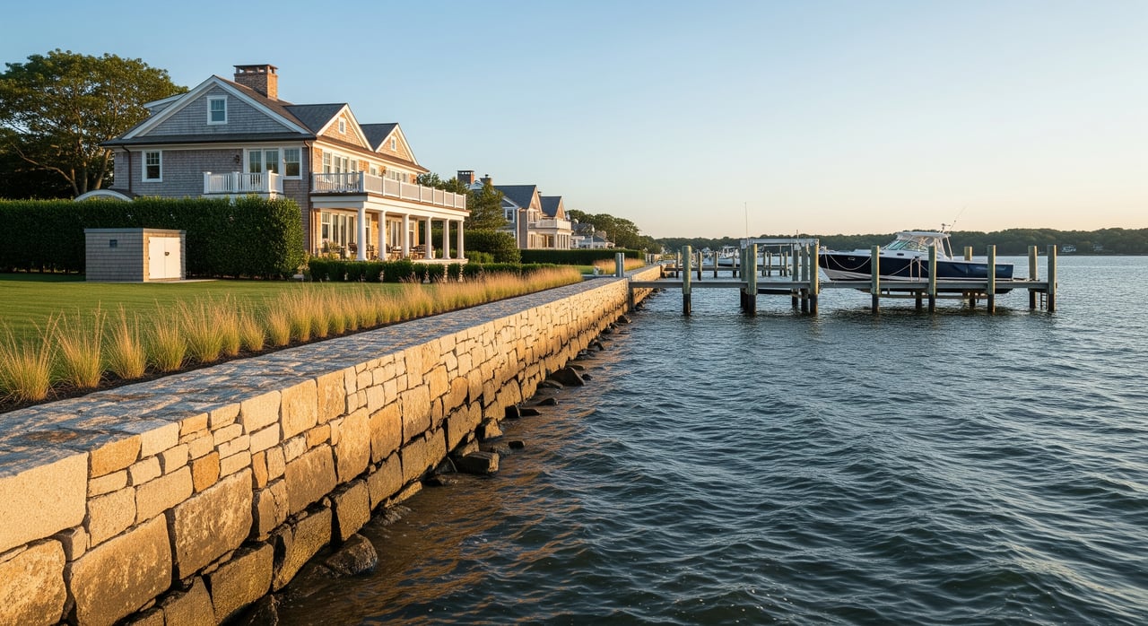
Greenwich experiences tidal flooding, storm surge from hurricanes and nor’easters, episodic stream flooding along corridors like Brothers Brook, coastal erosion, and long‑term sea level rise. These hazards can overlap, which is why preparation matters.
Sea level rise planning
Connecticut planners recommend preparing for an upper‑end scenario of about 20 inches of sea level rise in Long Island Sound by 2050. That planning guidance helps you compare homes today with how water could behave decades from now. You can review the state’s recommendation in CIRCA’s summary of the planning baseline for Connecticut’s coast. CIRCA’s guidance on 20 inches by 2050
Local vulnerability work
Greenwich completed a townwide Coastal Resiliency Assessment that maps impacts to parks, tidal ponds, and town facilities. It also flagged on‑site sewage systems as a vulnerability to review during inspections. Use this report to understand neighborhood context before you write an offer. Greenwich Coastal Resiliency Assessment
FEMA flood maps and what they mean
FEMA’s Flood Insurance Rate Maps identify Special Flood Hazard Areas, which inform insurance requirements and many permitting decisions. Coastal properties often fall in Zones AE or VE. VE is a coastal high‑hazard zone with wave action that requires stricter construction standards, while AE is a 1 percent annual chance flood zone with a base flood elevation. FEMA guidance on coastal flood zones
FEMA maps show current designated flood risk. They do not automatically show future sea level rise. For the current official designation of a specific property, search the FEMA Flood Map Service Center. FEMA Flood Map Service Center
Rules and permits near the shore
Connecticut regulates work waterward of the coastal jurisdiction line and sets standards for coastal management. If you are considering construction, additions, or shoreline work, review state and local guidance early in your planning. Connecticut Coastal Management Manual
Greenwich’s Building Zone Regulations and Planning & Zoning processes control development in mapped floodplains, including elevation and permitting requirements consistent with state and federal standards. If your home search includes waterfront or low‑lying areas, confirm what is allowed on that lot before you finalize plans. Greenwich Building Zone Regulations
Insurance and lending essentials
If a home is in a FEMA‑mapped Special Flood Hazard Area and your mortgage is from a federally regulated or backed lender, flood insurance will be required. Expect a typical 30‑day waiting period for new National Flood Insurance Program policies unless a limited exception applies. Flood insurance basics and requirements
You can compare NFIP coverage with private flood insurance. If you plan to use private flood insurance to satisfy a lender requirement, it must be at least as broad as NFIP coverage. Ask your insurance professional to walk you through building vs contents coverage, deductibles, and exclusions.
Community rating discounts vary by town. Greenwich has been identified in regional CRS assistance efforts, so do not assume a townwide discount applies. Verify the premium for the specific property with your insurer.
If an Elevation Certificate shows your home sits above the Base Flood Elevation, you may be eligible for a Letter of Map Amendment that can change the property’s FEMA designation. This process requires certified survey data and FEMA review. FEMA LOMA and map change process
Your coastal due diligence checklist
Use this step‑by‑step list to evaluate a Greenwich property with confidence:
- Confirm the flood zone and map panel early. Look up the property in the FEMA Map Service Center and ask for any existing Elevation Certificate or Letters of Map Change. FEMA Map Service Center
- Ask about flood history and claims. Request written disclosures about past flooding or water intrusion and any prior insurance claims.
- Order an Elevation Certificate or survey if needed. If the home is in an SFHA, you will want the lowest‑floor elevation relative to the Base Flood Elevation. Consider LOMA eligibility if data shows the structure is above BFE. FEMA LOMA process
- Get insurance quotes early. Compare NFIP and private options, building and contents limits, and waiting periods. NFIP overview
- Expand inspections to include flood resilience. Ask your inspector to evaluate grading, drainage, foundation, flood vents, and locations of mechanicals. For coastal homes, consider a structural or civil engineering review and a septic or sewer assessment. Town resiliency assessment reference
- Review evacuation and utilities. Learn the property’s evacuation zone, nearest route, and local shelters. Register for GreenwichAlerts and consider backup power for pumps and sump systems. Greenwich Emergency Information
- Plan mitigation if the property is at risk. Common measures include elevating mechanicals, installing compliant flood vents, improving site drainage, or elevating the structure in VE zones under professional guidance. FEMA coastal zone standards
- Track potential grants, but do not rely on them. Programs and eligibility change, and awards are not guaranteed.
- Keep thorough records. Save certificates, map change letters, quotes, and disclosures for your lender and future resale.
Move‑in readiness
Before the first high tide or major storm, set up alerts and a simple household plan. Register for town alerts, know your evacuation zone and shelter options, and keep flood insurance documents handy. Test your sump pumps, label the main shutoffs, and confirm that mechanical systems are elevated or protected.
A thoughtful plan turns coastal living from a worry into a luxury. If you want a private, senior‑level advisor to quarterback due diligence, permitting and negotiations around coastal property, reach out to Kara Cugno for a discreet, white‑glove experience.
FAQs
How risky is sea level rise for Greenwich homebuyers?
- Connecticut planners recommend preparing for up to about 20 inches of sea level rise by 2050, which can increase the frequency and depth of tidal flooding and storm surge.
What do AE and VE zones mean for construction?
- AE indicates a 1 percent annual chance flood with a base flood elevation, while VE adds coastal wave action that usually requires open foundations and stricter standards.
Do I need flood insurance if I am outside the FEMA flood zone?
- Lenders can require flood insurance even outside Special Flood Hazard Areas, so get quotes and confirm your lender’s policy.
How do I check a Greenwich property’s flood zone?
- Search the address in FEMA’s Flood Map Service Center and ask the seller for any Elevation Certificate or Letters of Map Change.
How long before a new flood policy takes effect?
- NFIP policies typically have a 30‑day waiting period, with limited exceptions such as certain loan closings.